GstarCAD > GstarCAD > GstarCAD Point Cloud 2025
GstarCAD Point Cloud 2025
Wir freuen uns, GstarCAD Point Cloud vorzustellen!
Dies ist eine leistungsstarke Lösung mit einem vollständigen Werkzeugsatz zum nahtlosen Importieren und Verwalten von Punktwolken direkt in GstarCAD.
Paket zur Umwandlung von Punktwolken in CAD-Daten
GstarCAD ist eine alternative CAD-Software, die mit ACAD hochkompatibel ist. Mit ständiger Weiterentwicklung und Innovation übertrifft GstarCAD seine Wettbewerber deutlich in Bezug auf Leistung, Stabilität und andere Schlüsselmerkmale und wird zu einer der führenden CAD-Lösungen weltweit.
Die Software bietet alle bekannten ACAD-Funktionen sowie innovative Werkzeuge zur Vereinfachung des Designprozesses.
Undet bietet ein spezielles Plugin für GstarCAD, das auf Unternehmen zugeschnitten ist, die geodätische Daten erfassen und Punktwolken modellieren. Es vereinfacht tägliche Arbeitsprozesse, steigert die Produktivität und reduziert den Aufwand, um Punktwolken in aussagekräftige Ergebnisse wie 3D- und BIM-Modelle oder 2D-Zeichnungen umzuwandeln.
Erfahren Sie mehr über GstarCAD.
GstarCAD is an alternative CAD software with high compatibility with ACAD. Through continuous improvement and innovation, GstarCAD far outshines its competitors in performance, stability and other key indicators, becoming one of the leading CAD software in the world. It offers all the features you know from ACAD, as well as innovative tools designed to streamline the design process.
Undet offers a specialized plug-in for GstarCAD, tailored to the needs of companies involved in real-world data acquisition and point cloud modeling. It streamlines daily operations, increases productivity, and reduces the workload needed to transform point cloud data into meaningful outputs such as 3D and BIM models, as well as 2D drawings.
Mit dem Undet Indexer können Sie Punktwolkenprojekte aus Daten beliebiger Laserscanner oder Drohnen erstellen und sie direkt in GstarCAD öffnen, transformieren und verwalten.
(Unterstützte Formate siehe unten im Abschnitt „Funktionen“.)
Der „Undet Browser für GstarCAD“ bietet interaktive Bearbeitungs- und Visualisierungsfunktionen zur Analyse und Navigation durch digitale Daten im Panoramamodus – ideal zur Beschleunigung der Projekterstellung.
Narzędzie nawigacyjne jest widoczne w przestrzeni 2D lub 3D. Umożliwia łatwiejsze przełączanie między widokami standardowymi i izometrycznymi. Składa się z sześcianu, kompasu i opcji, które można przeciągać i klikać. Obsługuje przełączanie do dowolnych widoków, przewijanie bieżącego lub ustawianie go jako widoku głównego.
Polecenie BTABLE przechowuje odmiany bloku dynamicznego w tabeli właściwości bloku,
która zawiera takie właściwości, jak parametry starszego typu i parametry użytkownika.
Każdy wiersz w tabeli definiuje inną odmianę
bloku dynamicznego.
Za pomocą polecenia VPSYNC można zsynchronizować jedną lub więcej rzutni układu z rzutnią układu głównego, aby dopasować dokładne lokalizacje. Zsynchronizowane rzutnie używają współczynnika powiększenia rzutni głównej do oddzielnego drukowania długich rysunków lub precyzyjnego dopasowywania map.
Opcje „Prostokątne”, „Wielokątne” i „Modyfikuj” zostały dodane do polecenia REVCLOUD. Można też kontrolować liczbę uchwytów wyświetlanych na prostokątnej lub wielokątnej chmurce wersji. Możesz więc łatwiej utworzyć chmurkę wersji lub przedefiniować istniejącą.
GstarCAD umożliwia obsługę plików formatu SVG (Scalable Vector Graphics). Zarówno w zakresie eksportu jak i importu.
Nowe funkcje w panelu poleceń CUI, czyli „Elementy kontrolne wstążki” i „Elementy kontrolne paska narzędzi” zostały dodane w celu ułatwienia filtrowania i dodawania elementów.
- Slice a point cloud quickly and easily using slice volume adjustment tools.
- A special tab for maximum focus on digitizing floor plans, divided into work stages: preparation, section view, floor view, and ceiling view.
- Clipping Box: Supports multiple point cloud clipping methods, allowing you to flexibly adjust the clipping box size or switch between different clipping boxes.
- Specialized tools for inserting dynamic blocks of windows, doors, openings and recesses, and pilasters with just a few mouse clicks.
- Dynamic elevation level blocks designed to describe drawings without requiring additional measurements or manual editing of attributes.
- The Undet Browser tool is a feature that allows you to automatically create height annotation blocks by clicking on 360-degree panoramic images: door heights, beam heights, room heights and floor levels at once, floor-to-window distance – from window sill to top of window, and much more.
- Auto-Multi line tool for quick extraction of 2D lines with one click to more accurately align them with the actual point cloud section.
- Automatic image orientation and UCS tools: by line, by point cloud section, and by plane/objects.
- Polyline aligned tool to instantly draw perpendicular lines from a selected reference line.
- Automated tools for grouping and scanning files into logical groups: external and internal level scans.
- An orthophoto creation tool for quickly converting point cloud sections into orthophoto images. The Profile View tool generates a profile view in plan view without changing the UCS or view orientation.
- This tool allows you to create a terrain grid that automatically extracts a clean land surface. In addition, it includes editing functions for this grid, such as reducing the number of points (decimal), closing open spaces, removing unnecessary protruding elements (pins), removing unnecessary edges, creating cross sections, and extracting contour lines.
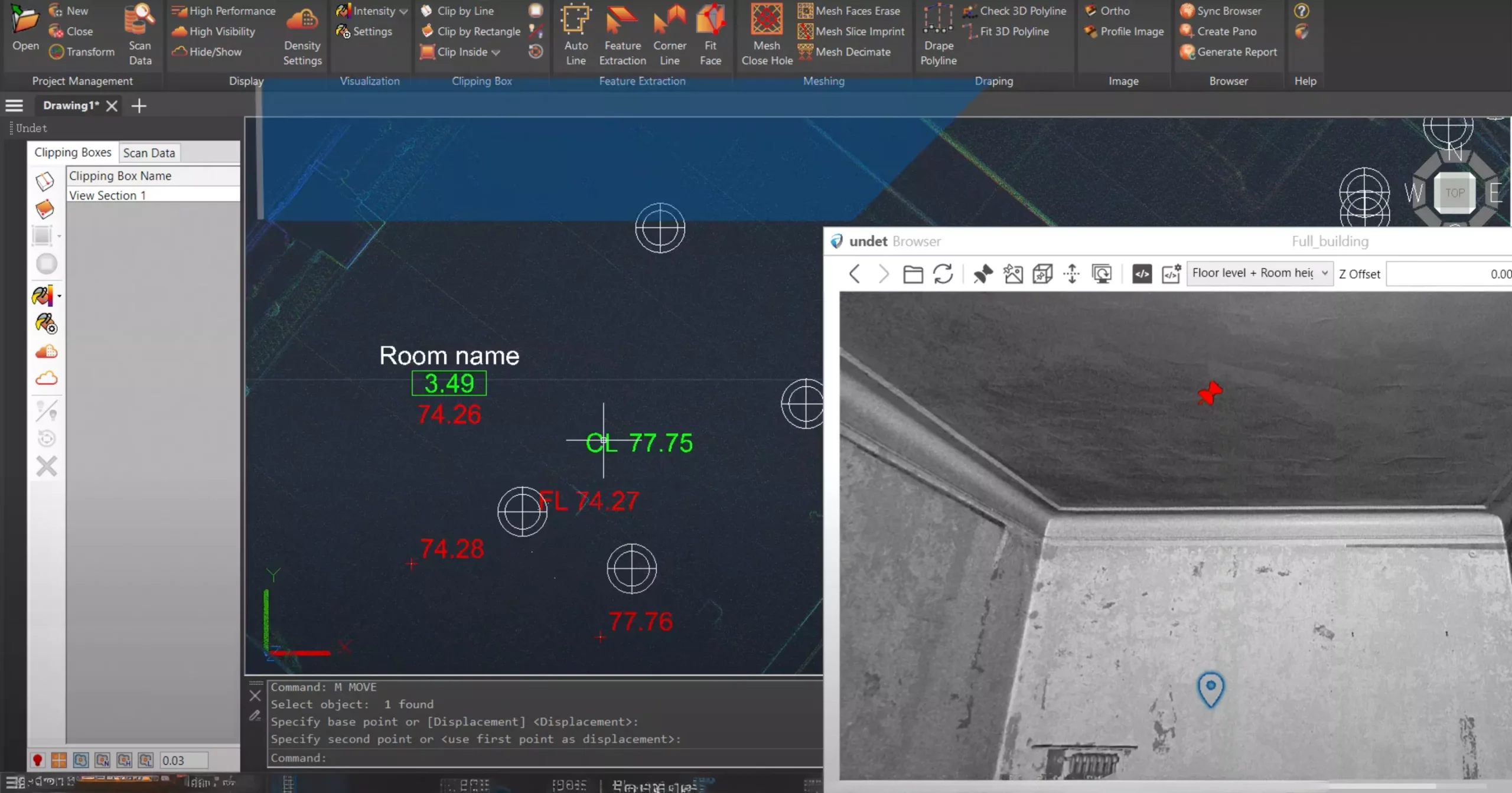
Automatic view synchronization function: allows you to orient the view from the nearest scanning stations in the Undet viewer to the blurred point cloud cross-section view with a single click.
Quick access to the point cloud browser: enables viewing and analyzing 3D reality data as if you were on site.
Rendering mode, point cloud coloring by reference plane at fixed intervals: allows you to quickly understand geometric changes in order to draw or identify missing lines/objects.
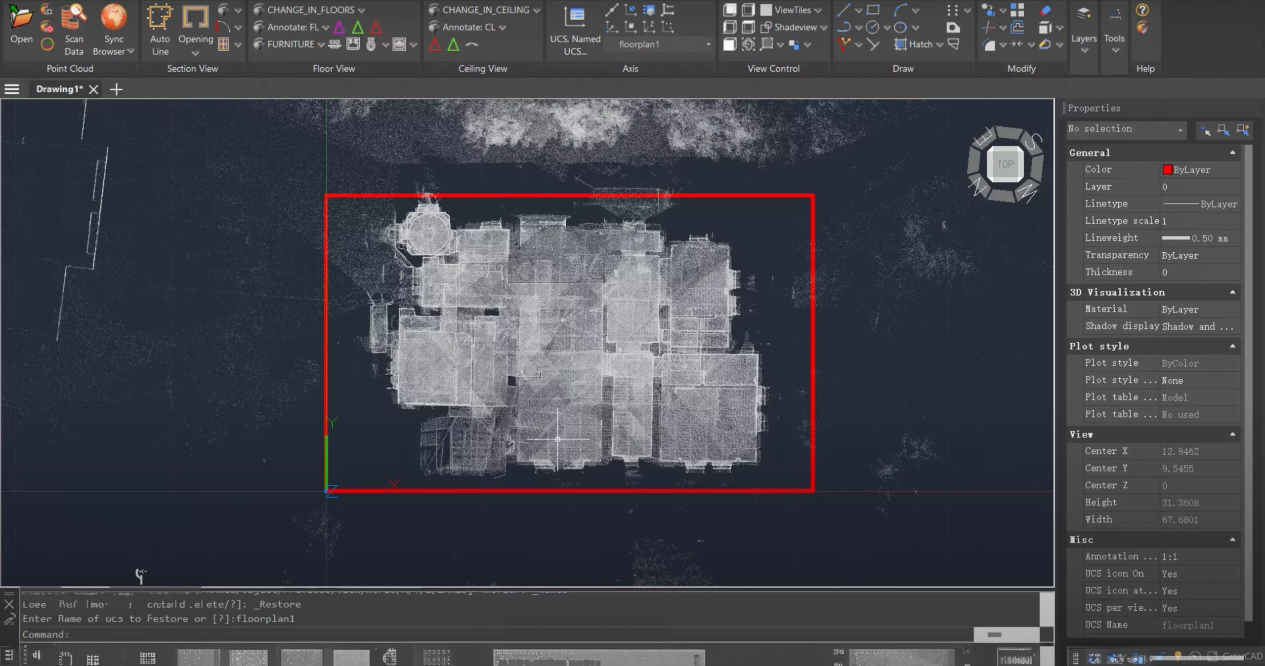
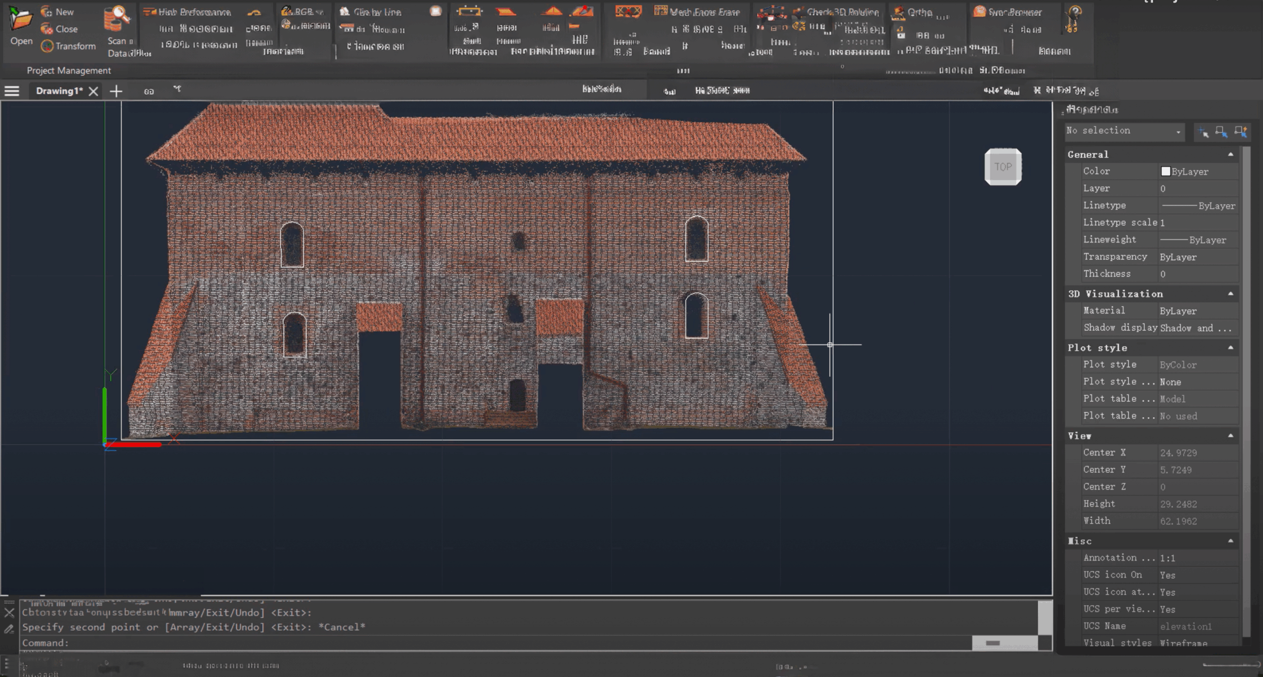
Profile section view generation tools: available in plan view without changing the drawing plane or rotating the view projection.
Model inspection coloring mode: used to verify the accuracy of a 3D model and identify missing details using real-time point cloud visualization during modeling.
Model inspection quality control report generation tools: allow you to compare the 3D model with the point cloud and display the report in the Undet browser, based on 360-degree scan station images.
3D orbit rotation tools: allow you to select a rotation center from the point cloud.
Smart snapping mode: enables snapping to cloud points in various ways (nearest, highest, and lowest points) and ignoring snapping errors caused by noise points.
100% DWG. GstarCAD uses the latest DWG file format without the need for import or export. Read and modify drawings created with AutoCAD® (or other similar programs) and save them directly in the same format. This applies to any DWG version — from the oldest to the newest.
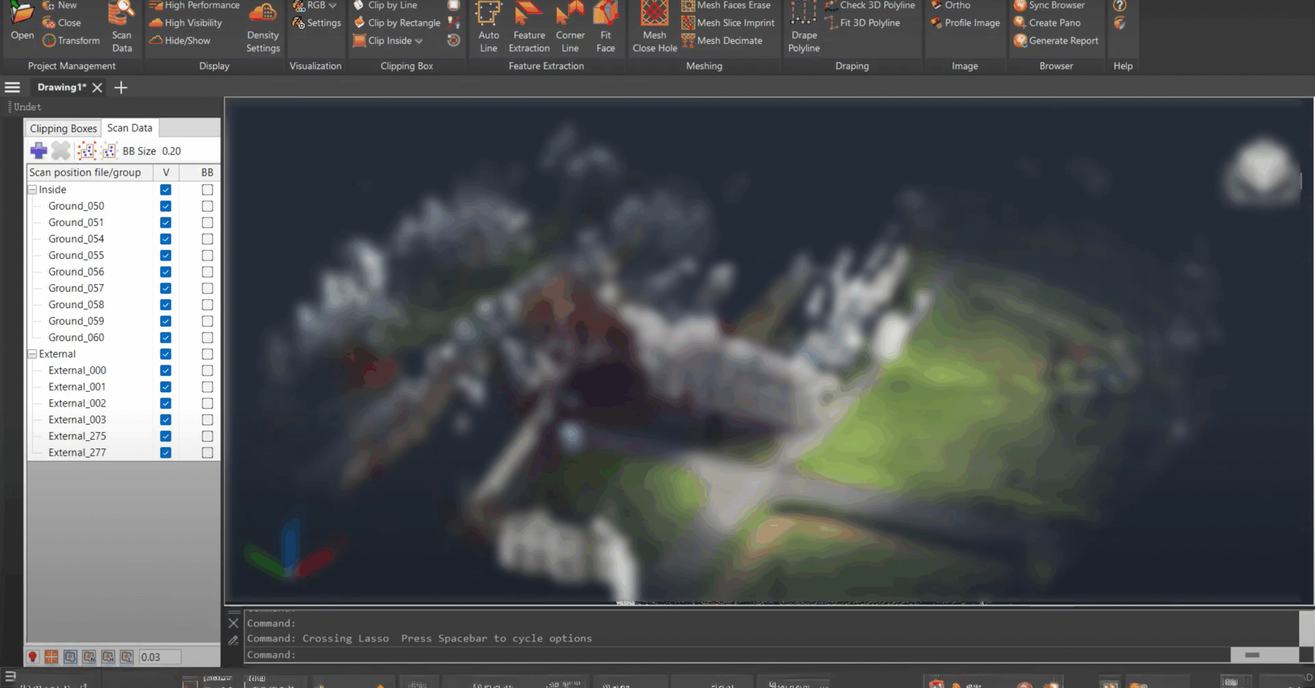
Import point clouds from any laser scanner or drone: *.E57, *.FLS, *.RCP/RCS, *.PTX, *.ZFS, *.LAS, *.LAZ, *.PTS, *.PLY, *.DP, *.FPR, *.LSPROJ, *.FWS, *.CL3, *.CLR, *.RSP, ASCII / NEZ (X,Y,Z/i/RGB), and custom ASCII / TXT file formats.
Point cloud visualization with multiple coloring modes: by source (RGB), by intensity, by plane, by Z-axis (height), by scan station, and with an additional transparency mode.
The software is optimized to maintain high computer and software performance even when working with large point cloud datasets (hundreds or even thousands of stations / scan files).
Intuitive integration in the point cloud browser for a better understanding and visualization of what the point cloud represents.
The coordinate system manager allows you to quickly move the point cloud and align it with the UCS or transfer it to optimized coordinates, preventing display issues when working with georeferenced point clouds.
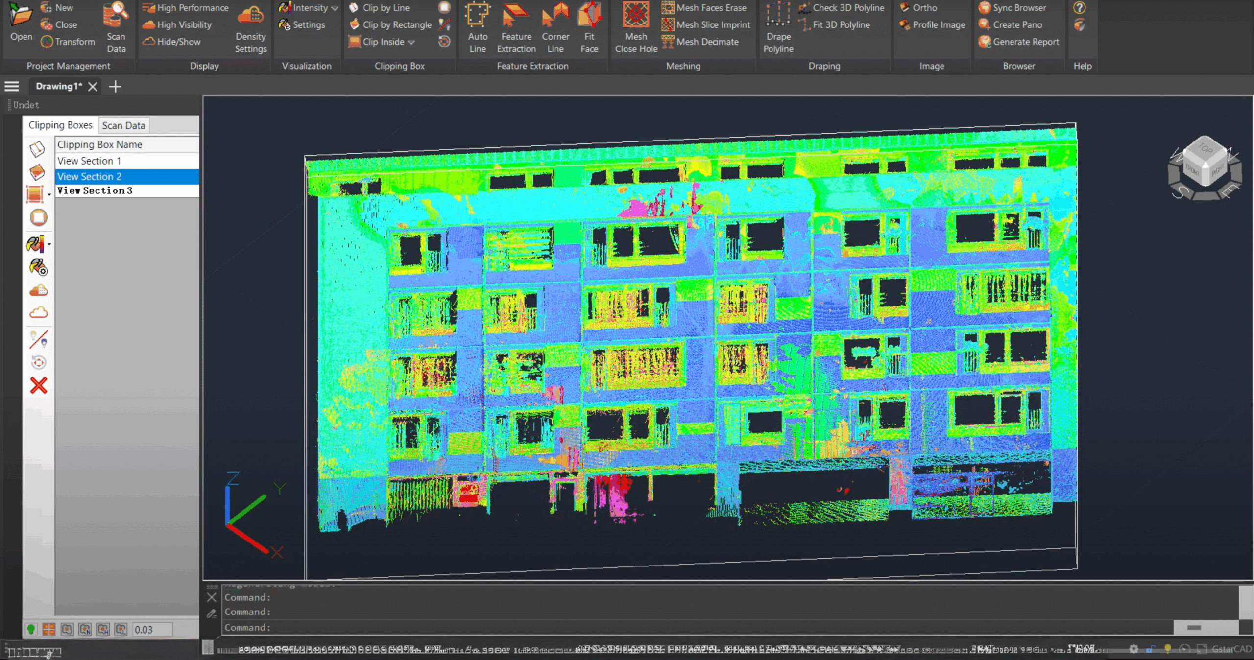
A dedicated toolset for managing point cloud view sections: activate, deactivate, delete, rename, or export as a new Undet project.
Lightning-fast switching between station / scan file / view section tools using an intelligent cursor that quickly detects the densest scan file within the active view section.