Customize Consent Preferences

We use cookies to help you navigate efficiently and perform certain functions. You will find detailed information about all cookies under each consent category below.

The cookies that are categorized as "Necessary" are stored on your browser as they are essential for enabling the basic functionalities of the site. ... 

Always Active

Necessary cookies are required to enable the basic features of this site, such as providing secure log-in or adjusting your consent preferences. These cookies do not store any personally identifiable data.

No cookies to display.

Functional cookies help perform certain functionalities like sharing the content of the website on social media platforms, collecting feedback, and other third-party features.

No cookies to display.

Analytical cookies are used to understand how visitors interact with the website. These cookies help provide information on metrics such as the number of visitors, bounce rate, traffic source, etc.

No cookies to display.

Performance cookies are used to understand and analyze the key performance indexes of the website which helps in delivering a better user experience for the visitors.

No cookies to display.

Advertisement cookies are used to provide visitors with customized advertisements based on the pages you visited previously and to analyze the effectiveness of the ad campaigns.

No cookies to display.

Pramonės perdangos > Spatial Manager Basic

Spatial Manager Basic

Spatial Manager yra GstarCAD perdanga, sukurta siekiant patenkinti šiuolaikinių geodezininkų poreikius. Tai leidžia efektyviai valdyti geoerdvinius duomenis GstarCAD aplinkoje.

1 320,00 PLN

Spatial Manager Basic


Pagrindinės „Spatial Manager Basic“ funkcijos:

  1. bendras.
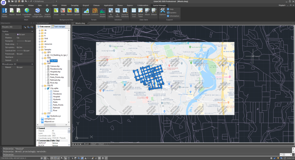
  • Importuokite erdvinius duomenis į GstarCAD brėžinius
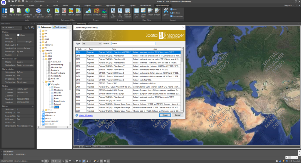
  • Koordinačių transformacija

2 Duomenų importavimas

  • Importuokite objektus į naują arba atidarytą piešinį
  • Pirminis tikslinis sluoksnis arba nauji tiksliniai sluoksniai naudojant lauko reikšmes
  • Blokų taikymas taškams ir centroidams
  • Parametrai blokams įterpti iš lauko reikšmių
  • Daugiakampių užpildymas ir skaidrumas
  • Elementų žymėjimas importavimo metu
  • Erdvinis filtras
  • Greito importo funkcija

3 Duomenų šaltiniai

  • Savo nuorodų tvarkymas
  • Prieiga prie erdvinių duomenų failų (SHP, GPX, KML, OSM, GML ir kt.).

Pramonė: geodezijos